|
Guide To Oregon's Snow Shoeing
|
|
|
|
There are numerous snowshoeing
trails in Oregon with plenty of
books available to show the
numerous routes. Below are some
of the most popular snowshoeing
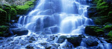
trails.Trillium Lake is one of the most popular
snowshoeing sites close to Portland. It
is a five mile course around Trillium
Lake and offers beautiful views. You
will find this hike just past Government
Camp right off the highway.
Mirror Lake is another very popular
snowshoeing site close to Government
Camp. You will find peace and quiet with
beautiful views. It is an easy 3 mile
loop which makes it good for beginners.
Barlow Pass is a somewhat difficult 6
mile cross country hike which uses the
Pacific Crest National Scenic Trail and
is close to Government Camp. The
trailhead elevation is 3,900 feet with
the top elevation at 4,500.
Frog Lake is a 1.5 mile out and back
easy hike which makes it great for
children. It is also popular with
snowmobiles so it is better to go on a
week day. The nearest city is Government
Camp.
Twin Lakes is a destination you may want
to try to get away from crowds. It is
about 3 miles from the parking lot and
is less popular than Trillium Lake or
Frog Lake. You should be an experienced
at snowshoeing to tackle this 8 mile
loop. The closest city is Government
Camp.
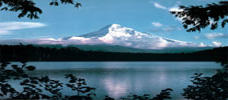
White River is a very popular out and
back route totally 3 miles. There is an
elevation gain of 600 feet and is rated
difficult. Government Camp is the
closest city. This route offers
spectacular view of Mount Hood. The
trail begins at the White River Sno-Park.
Crosstown Trail is another Government
Camp Snowshoe Trail. This trail goes
within yards of the town of Government
Camp. It is an easy point-to-point 3
mile trail with minimal elevation gain.
Broken Top is a Bend Snowshoe Trail
where the mountains are formed by severe
volcanic action and you can see it all
on this 10 mile out and back hike. The
closer you get to the summit of Broken
Top the more impressive the sites are.
Tom, Dick, and Harry is a popular 5 mile
hike in which cross country skiers
generally stay away from because of its
steepness. It has an elevation gain of
1,600 feet and is rated difficult. The
closest city is Government Camp.
Cooper Spur is a very difficult 4 mile
route on the east side of Mt. Hood. The
closest city is Hood River. The route
takes you through the back country.
Yellowjacket Trail is a challenging 6
mile point-to-point hike where you will
see some beautiful scenery. It can get
steep at times which keeps some
cross-country skiers away. Government
Camp is the closest city.
Illumination Saddle is a 5 mile
out-and-back hike through backcountry
which you can do from December through
August. The hike starts at 5,800 feet
elevation and reaches 9,500 feet in
elevation. Government Camp is the
nearest city.
Tilly Jane Creek is an easy 3 mile out
and back hike which you can do January
through March. In order to take this
trip, you need to get to Cloud Cap Inn,
first. The closest city is Hood River.
Crater Lake Loop/Rim Drive is one of
Oregon's classics and major hike. You
will need to allow 3-4 days and will
need some backcountry know-how. This is
a 33 mile loop which is difficult. You
may take this hike from January through
May. The nearest city is Fort Klamath.
Cloud Cap Inn is a 12 mile loop rated
difficult. You may do this hike from
November through April. Plan on at least
4-8 hours to do the hike and also plan
to do a lot of up hill climbing to a
historic cabin. Hood River is the
nearest city.
Crater Rock is serious hike which can
take you above the clouds and
spectacular views. This is an
out-and-back hike 6 miles long but plan
on taking 6 hours to do it. This hike is
generally available January through
June. The closest city is Government
Camp.
Swampy Lakes Trail is popular because
there are many varied trails you can
take from the Swampy Lakes Sno-Park. You
can find trails from 2-8 times varying
from easy to moderate. The closest city
is Bend.
Opal Creek is a 7 mile difficult
out-and-back loop where you may see some
trees that are 1000 years old. There is
minimal elevation gain on this loop and
it is generally open for snowshoeing in
December and January. Mehama is the
nearest city.
Silcox Hut is a short 2 mile out and
back hike but it is rated difficult as
you will be crossing glaciers. To get
there you will need to climb up the
mountain above the tree line. The
nearest city is Government Camp.
Todd Lake is fairly tucked away from the
noise of snowmobiles or cars. This is a
6.5 mile loop that is rated difficult
although there is very minimal elevation
gain. Bend is the nearest city to this
hike.
Maidenfoot Nordic Trail is a 4.2 mile
moderate difficulty hike that traverses
side slope from Rosary Lakes to Malaks
Mountain Nordic. From Willamette Pass:
Along Highway 58. Proceed 1/8 mile to
Highway Department sand shed entrance
north of highway. Parking lot is to the
right.
|